படிமம்:Rangifer tarandus map.png
Jump to navigation
Jump to search
இந்த முன்னோட்டத்தின் அளவு: 280 × 139 படப்புள்ளிகள் . மற்ற பிரிதிறன்: 1,600 × 794 படப்புள்ளிகள் .
மூலக்கோப்பு (1,600 × 794 படவணுக்கள், கோப்பின் அளவு: 113 KB, MIME வகை: image/png)
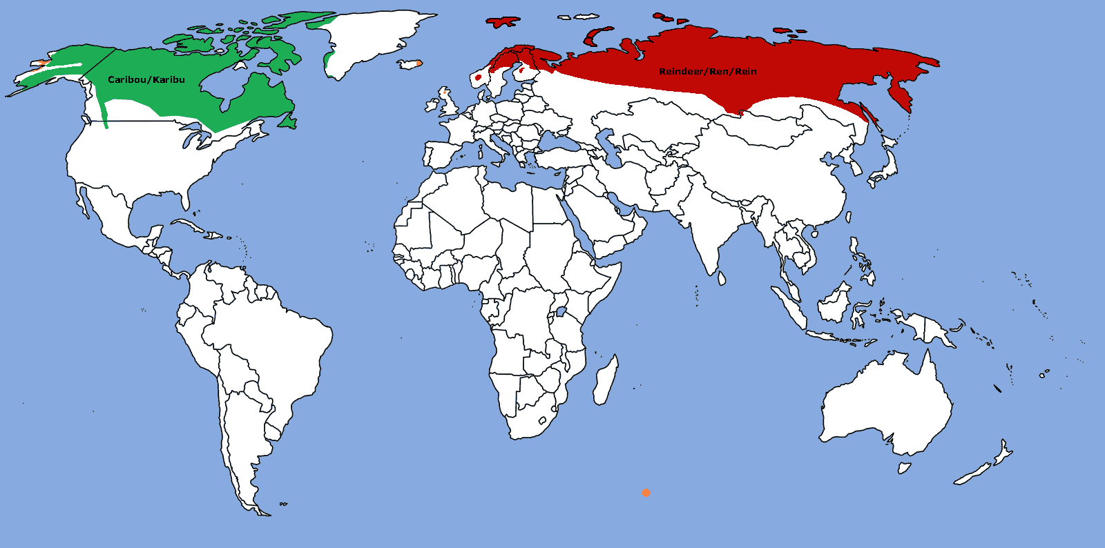
சுருக்கம்
| விளக்கம் |
Map: Distribution of Rangifer tarandus (Caribou/Reindeer)
|
| நாள் | |
| மூலம் | சொந்த முயற்சி |
| ஆசிரியர் | TBjornstad 11:46, 31 October 2006 (UTC) |
| அனுமதி (இக்கோப்பை மீண்டும் பயன்படுத்துதல்) |
Public Domain |

|
This biogeographical map image could be re-created using vector graphics as an SVG file. This has several advantages; see Commons:Media for cleanup for more information. If an SVG form of this image is available, please upload it and afterwards replace this template with
{{vector version available|new image name}}.It is recommended to name the SVG file “Rangifer tarandus map.svg”—then the template Vector version available (or Vva) does not need the new image name parameter. |
அனுமதி
| I, the copyright holder of this work, release this work into the public domain. This applies worldwide. சில நாடுகளில் இது சாத்தியமில்லாது போகலாம். அவ்வாறாயின் : I grant anyone the right to use this work for any purpose, without any conditions, unless such conditions are required by law. |
கோப்பின் வரலாறு
குறித்த நேரத்தில் இருந்த படிமத்தைப் பார்க்க அந்நேரத்தின் மீது சொடுக்கவும்.
| நாள்/நேரம் | நகம் அளவு சிறுபடம் | அளவுகள் | பயனர் | கருத்து | |
|---|---|---|---|---|---|
| தற்போதைய | 10:06, 26 அக்டோபர் 2025 | | 1,600 × 794 (113 KB) | wikimediacommons>Fenn-O-maniC | Updated the borders of Montenegro, Kosovo, and South Sudan |
கோப்பு பயன்பாடு
பின்வரும் பக்க இணைப்புகள் இப் படிமத்துக்கு இணைக்கபட்டுள்ளது(ளன):